A 24-channel Geode seismograph with 4.5 Hz vertical geophones laid across a traverse in the Maitai Valley picks up hammer impacts on an aluminium plate, each stacked strike sending a compressional wave through the gravels and weathered argillite beneath. In Nelson, where the topography shifts abruptly from the Richmond Range foothills to the Tasman Bay alluvial flats, seismic tomography provides the continuous velocity cross-section that borehole logs alone cannot resolve. We run both refraction and reflection acquisition depending on target depth: refraction for overburden thickness and rippability down to 30–40 metres, reflection for deeper structure when foundation design for the port area or hillside subdivisions demands it. The recorded travel-time curves feed into a tomographic inversion algorithm that iterates from an initial 1D model, updating slowness cells until the misfit between observed and calculated first arrivals stabilises. Because Nelson’s geology juxtaposes Moutere Gravels, Port Hills loess, and the Dun Mountain–Maitai terrane boundary, velocity contrasts can exceed 1500 m/s across short distances — a condition where ray coverage must be dense enough to avoid smearing the interface. The crew typically lays 48–96 channels with 2–5 metre spacing, and where site access permits, we supplement the hammer with a weight drop or Betsy Seisgun to boost signal penetration beyond 60 metres. For sites near the Whakatu Drive corridor or the airport industrial zone, a companion MASW survey is often paired to extract Vs profiles for site class determination per NZS 1170.5, since the P-wave tomography alone does not yield shear-wave velocity directly.
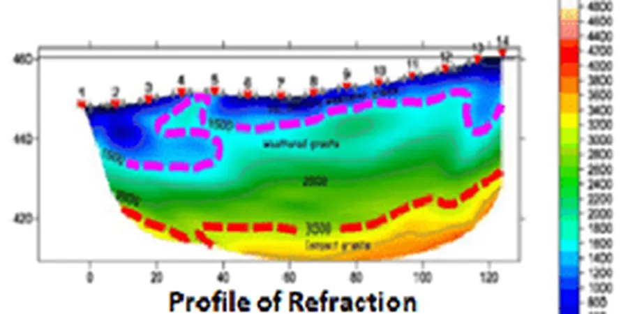
A well-sampled tomogram across the Moutere Gravel–Maitai contact can resolve the bedrock surface to within 0.5 metre vertically — tighter than any borehole interpolation alone.
Service characteristics in Nelson
Critical ground factors in Nelson
Nelson’s position astride the plate boundary, with the Waimea–Flaxmore Fault system running within 15 kilometres of the city centre, means that a velocity model built solely on sparse boreholes carries genuine risk for seismic site response. A 2021 GNS Science study of Nelson’s deep basin structure using gravity and passive seismic data confirmed that the Waimea Basin fill exceeds 400 metres in places — a geometry capable of amplifying long-period ground motion. Refraction tomography on its own does not image below the first high-velocity refractor, so when a site class determination or a liquefaction assessment is required, we combine the P-wave tomogram with a MASW array to extract the Vs30 profile. The dual-method approach reduces the epistemic uncertainty that arises when Vs is estimated from SPT N-values using generic correlations, which can misclassify a site by an entire class if gravel content is high. On hillside sites above the Port Hills, where loess overlies weathered bedrock, we also watch for velocity inversions: a soft layer beneath a stiff crust can cause first-arrival shadow zones that the inversion may misinterpret as lateral gradation if the spread length is insufficient. Our field notes flag any shot gather where the first-break pick is ambiguous, and those picks are weighted down during inversion. The result is a velocity model that honestly represents where the data constrain the solution and where interpretation is required — a distinction that the council’s peer reviewer will look for in the geotechnical report.
Our services
Every seismic tomography survey we deliver in Nelson includes the full chain from acquisition to interpretation, calibrated against local geology. The three core service components are:
Seismic Refraction Tomography Acquisition
Multi-channel P-wave acquisition with 2–5 metre geophone spacing, using hammer or weight-drop sources. Shot points at both ends and mid-spread positions for reciprocal travel-time control. Coverage designed to map the overburden–bedrock interface and internal velocity structure to depths of 30–80 metres depending on source energy.
Tomographic Inversion & Velocity Model Delivery
Curved-ray travel-time tomography processed with industry-standard software. Deliverables include a 2D velocity grid in CSV and CAD formats, an interpreted bedrock surface, and a ray-coverage density map that shows where the model is data-constrained versus interpolated.
Integrated Seismic Site Classification (Vs30)
Combined P-wave tomography and MASW acquisition on the same spread to deliver both Vp and Vs profiles. Vs30 calculated per NZS 1170.5 and NZGS guidelines, with a site class letter assignment ready for the structural engineer’s design basis report.
Frequently asked questions
What depth can seismic tomography reach in Nelson’s geology?
Refraction tomography with a sledgehammer source typically images to 30–50 metres in the Moutere Gravels and Port Hills terrain. A weight drop or Betsy Seisgun extends penetration to 60–80 metres. The limiting factor is the velocity contrast at the first high-velocity refractor: once the seismic wave refracts along a competent bedrock surface, energy returning from deeper interfaces is often too weak to pick reliably. For deeper basin structure we recommend reflection acquisition or a complementary passive-MASW array.
How does seismic tomography compare to borehole drilling for site investigation?
Tomography delivers a continuous 2D cross-section of P-wave velocity between source and receiver points, whereas boreholes provide point data with high vertical resolution. The two methods are complementary: our tomograms are always calibrated against any available borehole or test pit log to anchor the velocity–lithology relationship. On complex sites like the Maitai Valley, the combination reduces the risk of missing a buried channel or a steep bedrock step that a grid of boreholes might straddle without detecting.
What does a seismic tomography survey cost in the Nelson–Tasman region?
The fee for a seismic tomography survey in Nelson typically falls between NZ$5,160 and NZ$9,580 depending on the spread length, number of shot points, and site access conditions. A basic reconnaissance line of 115 metres with 24 channels sits at the lower end; a detailed 96-channel survey with multiple source positions and MASW integration moves toward the upper end. Every quote includes data processing, tomographic inversion, and a signed geophysical report.
Can seismic tomography detect cavities or karst features?
Yes, provided the cavity is large enough relative to its depth and the geophone spacing is sufficiently dense. In the Nelson region, where karst is uncommon but volcanic lava tubes or erosion pipes in Moutere Gravels can occur, a velocity anomaly of 300–500 m/s below the background value is typically resolvable. We configure the spread with 1–2 metre spacing when cavity detection is the primary objective, and the inversion is run with a fine mesh to avoid smearing the anomaly.
How long does a seismic tomography survey take on site?
A standard 48-channel refraction line with hammer source takes one field crew roughly 2–3 hours to lay out, shoot, and pack up, assuming reasonable access on foot. A full day typically allows 2–3 spreads of 115–135 metres each. Processing and interpretation add 3–5 working days depending on the complexity of the velocity model and the number of lines to be correlated.